Noosa Everglades Map And Route: Every Distance, Launch Point And Leg Time
The Noosa Everglades is a 27.7 km stretch of the upper Noosa River inside the Cooloola Recreation Area, and almost every question about visiting it comes down to geography: where the road ends, where the water starts, and how far each leg takes to paddle or cruise. This guide maps the whole route, leg by leg, with the official distances and times, plus the launch point every bookable tour uses.
Short answer
The upper Noosa River runs 27.7 km one way inside the Cooloola Recreation Area, Great Sandy National Park. Tewantin to Boreen Point is 19 km by road, Boreen Point to Kinaba is 7 km by boat, and Elanda Point to Kinaba is 4.5 km by canoe. The paddling journey ends at campsite 15, the furthest point upstream.
Where Is The Noosa Everglades On The Map?
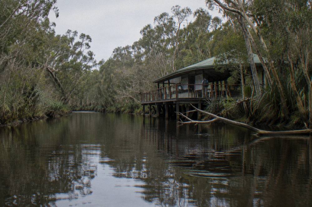
The place most visitors call the Noosa Everglades sits on the upper Noosa River inside the Cooloola Recreation Area, part of Great Sandy National Park, on the Sunshine Coast between Noosa Heads and Rainbow Beach. Queensland Parks and Wildlife Service maps it as the Upper Noosa River waterway, a 27.7 km one-way journey, and names the narrow reflective stretch The Narrows.
The naming matters when you read a map. "Noosa Everglades" and "River of Mirrors" are operator and listing names, the kind of language tour pages use freely, while the official park pages call the whole area the Cooloola Recreation Area and the waterway the Upper Noosa River. Nothing is lost between the two: the dark tannin-stained water, the twisted paperbarks and bloodwoods reflected in it, and the 2.5 km stretch through The Narrows are all on the official waterway page, described in almost the same words the tours use. The park service simply declines the marketing flourish, including the "one of only two everglades in the world" claim, which appears only in operator copy.
Geographically, the route is simple. The Noosa River flows south from the Cooloola sandmass toward the lakes and estuary at Noosa. Two-thirds of the river's catchment is protected inside the national park, and the upper section, the part this site covers, runs from the Elanda Point and Boreen Point access roads in the south to campsite 15 in the north, beyond which it is not possible to proceed upstream. Everything a visitor books, paddles or cruises happens along that corridor.
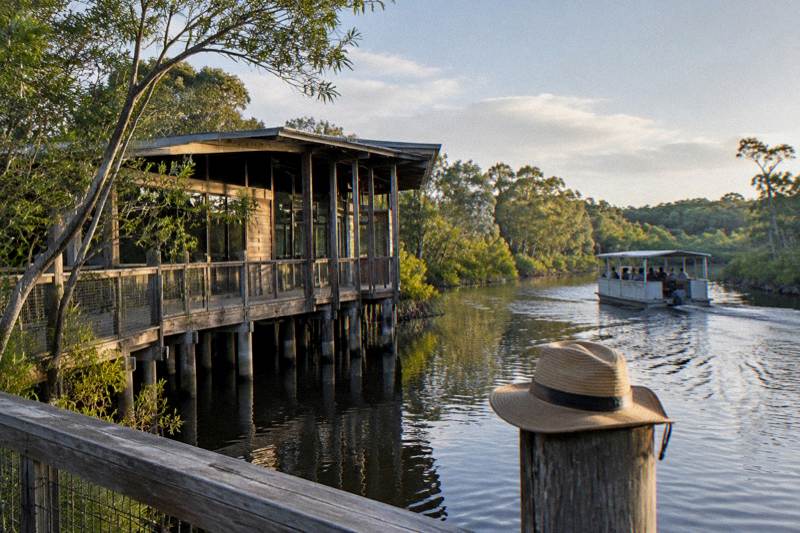
The practical map for planning has three anchors. Tewantin is the last town, 19 km of road from Boreen Point. Boreen Point and Elanda Point are the two launch areas on Lake Cootharaba and the southern river, both reachable by 2WD. Kinaba Information Centre, Fig Tree Point and Harry's Hut are the landmarks on the water that structure every tour and every multi-day paddle. The rest of this guide walks that corridor in order.
If you want the deeper background on the reflective stretch itself, the River of Mirrors explained guide covers why the water looks the way it does, and the map and launch point detail at Boreen Point covers the main boat-ramp access in full.
The Full Route: 27.7 Km From Elanda Point To Campsite 15
The official journey is 27.7 km one way, with a suggested five hours of paddling time for the full distance. The route runs from Elanda Point across Lake Cootharaba to Kinaba, up through The Narrows past Fig Tree Point to Harry's Hut, then along a chain of 15 numbered campsites to campsite 15, the end of the line, where the park service states it is not possible to proceed upstream further.
The full waterway page from Queensland Parks and Wildlife Service gives the distance and the leg breakdown, and those figures are the backbone of every tour timetable and every multi-day itinerary. A day visitor never covers the whole 27.7 km under their own paddle power; the cruises motor the flat lake crossing, and the kayak days concentrate on the narrow, reflective upper section where the scenery is densest. But knowing the full route tells you what each tour is skipping, and why.
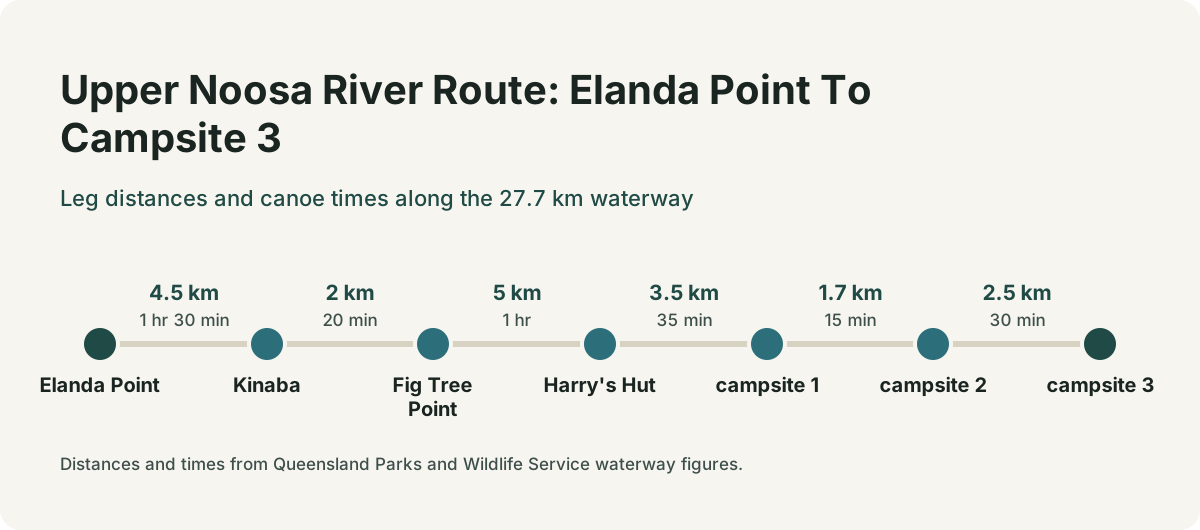
Here is the corridor, leg by leg, using the official distances:
| Leg | Distance | Notes |
|---|---|---|
| Tewantin to Boreen Point (road) | 19 km | Via McKinnon Drive and Louis Bazzo Drive, then Lake Flat Road |
| Elanda Point to Kinaba (canoe) | 4.5 km | About 1.5 hr paddle; boat time not stated |
| Boreen Point to Kinaba (boat) | 7 km | About 15 min by boat, 40 knot limit on the lake |
| Kinaba to Fig Tree Point | 2 km | 20 min by canoe, 15 min by boat |
| Fig Tree Point to Harry's Hut | 5 km | 1 hr by canoe, 30 min by boat |
| Harry's Hut to campsite 1 | 3.5 km | 35 min by canoe |
| Campsite 1 to campsite 2 | 1.7 km | 15 min by canoe |
| Campsite 2 to campsite 3 | 2.5 km | 30 min by canoe |
| Campsite 13 to campsite 15 | 3 km | 30 min by canoe; campsite 15 is the end |
Two structural facts shape the whole corridor. First, motorised vessels are permitted only as far as campsite 3; beyond that, only electric motors and non-motorised craft may continue, which is why the cruise fleet turns around in the Fig Tree Point to Harrys Hut area and why the far campsites belong to paddlers. Second, a six-knot, no-wash speed limit applies upstream from the Kinaba Information Centre, protecting the riverbanks from erosion, with penalties stated on the park pages. The upper river is deliberately a slow place.
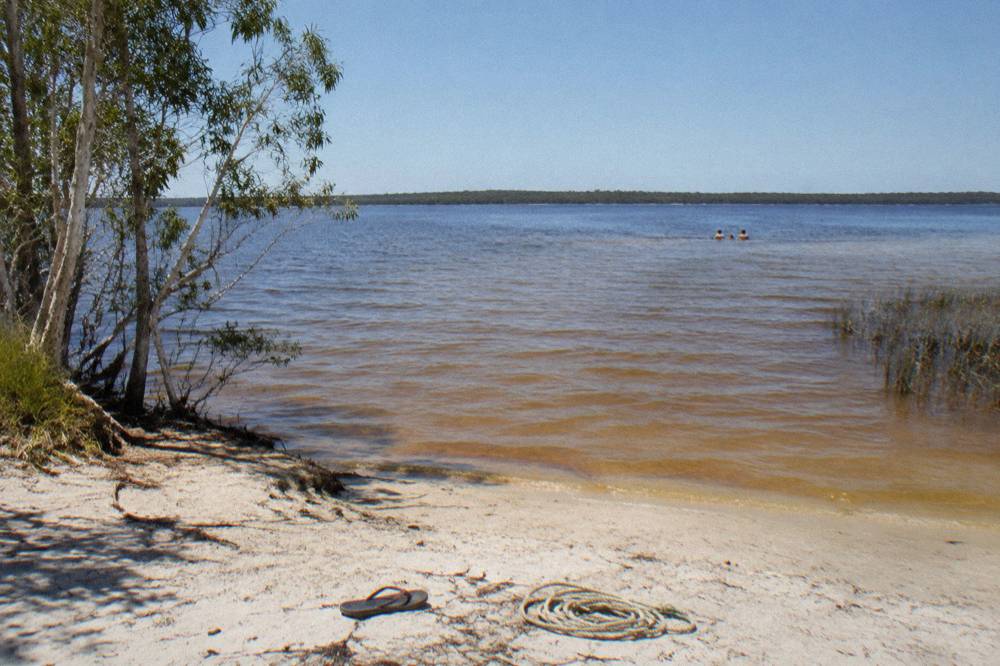
The lake crossing is the part first-time visitors underestimate. Lake Cootharaba is broad and shallow, and the park service advises planning to cross it early in the morning when conditions are likely to be calm and travel is easiest. Afternoon wind on the lake is the single most common reason a self-guided day runs late, and it is the reason the commercial cruises, which cross from Boreen Point in about 15 minutes, hold such a practical advantage for anyone who wants the scenery without the slog. The full lake picture, including the swimming and water quality questions, is in the Lake Cootharaba guide.
Canoe And Boat Times For Every Leg
Paddle times and boat times differ sharply on the same water. Boreen Point to Kinaba is 15 minutes by boat but there is no stated canoe time because canoeists launch from Elanda Point instead, 4.5 km and about 1.5 hours away. From Kinaba upstream, the canoe times are 20 minutes to Fig Tree Point, an hour to Harry's Hut and another 35 minutes to campsite 1, while boats take roughly half those times.
The split exists because the two launch points serve different craft. Boreen Point has the boat ramp used by the cruise fleet and larger vessels; Elanda Point, 2 km further along Lake Flat Road, is the canoe and kayak launch. If you are booking a cruise, your map starts at Boreen Point. If you are booking a kayak day or hiring a canoe, your map starts at Elanda Point, and the first 4.5 km of your day is the lake crossing to Kinaba. The two access roads are described in full in the Elanda Point guide.
For planning a self-guided or multi-day paddle, the canoe figures are the ones that matter, and they add up quickly:
| Leg | Canoe time | Boat time |
|---|---|---|
| Elanda Point to Kinaba | 1 hr 30 min | not stated (launch is at Boreen Point) |
| Boreen Point to Kinaba | not stated | 15 min |
| Kinaba to Fig Tree Point | 20 min | 15 min |
| Fig Tree Point to Harry's Hut | 1 hr | 30 min |
| Harry's Hut to campsite 1 | 35 min | motorised vessels not permitted past campsite 3 |
| Campsite 1 to campsite 3 | 45 min combined | not permitted |
| Campsite 13 to campsite 15 | 30 min | not permitted |
Read those numbers against the tour formats on offer. A 6-hour kayak day from Elanda Point has time for the lake crossing, The Narrows, a long lunch stop around Harry's Hut and a return paddle, but not much slack. A 2.5-hour afternoon cruise from Boreen Point motors the lake in minutes and spends its time in the reflective middle section. Neither reaches the far campsites; that is multi-day territory, covered in the upper river campsites 1 to 15 guide.
The Harrys camping page adds one useful cross-check: from Kinaba, paddle a further 1 hour 20 minutes to the Harrys camping area, which matches the 20-minute and 1-hour legs added together. The official figures are internally consistent, which is more than can be said for most tourist-area distance claims, and it means you can plan a day on them with reasonable confidence, allowing weather margin on the lake.
Where Every Tour Launches From
Every bookable tour on this river uses one of two launch points: the cruise fleet departs Boreen Point on Lake Cootharaba, and the kayak and canoe operators launch at Elanda Point, at the canoe launch on Lake Flat Road about 25 minutes north of Noosa by road. The private hinterland day collects you door to door, the afternoon and Explorer cruises run coach transfers from selected Noosa stops, and the kayak tours launch from Elanda Point with no pickup included.
The launch point determines your day more than any other single factor, because it sets your drive, your start time and which end of the river you see first. Here is how the main listings map onto the two access points:
| Tour | Launch point | Getting there |
|---|---|---|
| 2.5-Hour Afternoon Cruise | Boreen Point | Coach transfer from selected Noosa stops |
| Afternoon Tea Cruise | departure point on the live booking page | no pickup claimed |
| 4.5-Hour Cruise, Lunch Extra | courtesy shuttle from selected Noosa stops | confirm at booking |
| 6-Hour Canoe Trip, BBQ Lunch Extra | cruise departure plus canoe section | round-trip transfers from central Noosa can be arranged, confirm at booking |
| Full-Day Guided Kayak, Lunch Included | Elanda Point Canoe Launch, Lake Flat Road | no pickup, about 25 minutes north of Noosa |
| 6-Hour Self-Guided Kayak, No Pickup | Elanda Point Canoe Launch | no pickup |
| Private Hinterland Day | hotel pickup across the Sunshine Coast, Noosa and Hinterland | included, confirm area at booking |
The pattern is consistent. The cruises and cruise-plus-canoe days cluster around Boreen Point and the operator's own departure arrangements, while the pure kayak days, both Kanu Kapers listings and both Adventure Tribe listings, use the Elanda Point canoe launch at 204 Lake Flat Road. That address, the Habitat Noosa eco camp at Elanda Point, is the practical landmark: if your booking says Elanda Point, that is where you drive. The wider set of guides lives on Noosa Everglades Tours.
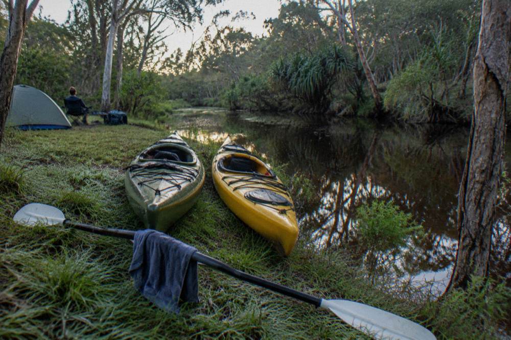
The featured full-day guided kayak tour is the one that turns the launch-point map into the most river. It meets at the Elanda Point Canoe Launch, runs about 6 hours from an 8:30am start with a guide for groups up to 16, and includes lunch, fresh fruit, baked bread and drinks, from $148 per person with a 4.9 rating from 158 reviews. Read the full detail on the full-day guided kayak tour page, or Check availability if the date is already fixed. The trade-off is the early start and the self-drive to Lake Flat Road; the reward is that the 4.5 km lake crossing and The Narrows both fall inside your day.
For a shorter taste of the same corridor, the 4.5-hour Explorer cruise runs 9am to 1.30pm with morning refreshments included and lunch to buy at the on-site bistro, from $117 per person, rated 4.6 from 279 reviews. Its sister listing, the canoe and barbecue day, is the same operator family with a different shape: the listing shows about 6 hours, and it is the one product that bridges both worlds, a cruise leg plus a canoe leg, with transfers from central Noosa that can be arranged at booking.
Getting There: Tewantin, Boreen Point And The Road Approach
From Brisbane, drive 135 km north on the Bruce Highway or Sunshine Motorway to Tewantin, then 19 km west and north via McKinnon Drive and Louis Bazzo Drive to Boreen Point, turning left onto Lake Flat Road for the final 2 km to the Elanda Point access road. From Gympie the drive is 58 km south and east to Tewantin. Both launching areas are accessible by 2WD vehicles.
Those are the official directions from the park service, and they hold for every season. The road quality is the pleasant surprise for first-time visitors: this is not a 4WD park entry like the Cooloola beach sections to the north. Harrys Hut Road, the rough 4WD track that reaches the upper river from the north-west, is a different matter entirely, and no tour on this site uses it; the tours all arrive from the sealed southern approach. Vehicle access permits are not required for Harrys Hut Road or Cooloola Way themselves, but that only matters if you are driving in, not paddling in from Elanda Point.
Two local road realities affect the drive in the current window. Doonella Bridge in Tewantin runs one-way eastbound only, Tewantin to Noosaville, until early December 2026, with westbound traffic detoured via Eumundi-Noosa Road and Beckmans Road, which adds time for anyone routing through Tewantin from the south. And the Boreen Point N4 amenities block on Boreen Parade is closed for roof replacement from 19 to 24 October 2026, with the nearest alternatives about 500 m away at the N3 block at Urangan Parade and the N5 picnic area at the caravan park. Neither closes the launch points; both are worth knowing before you park.
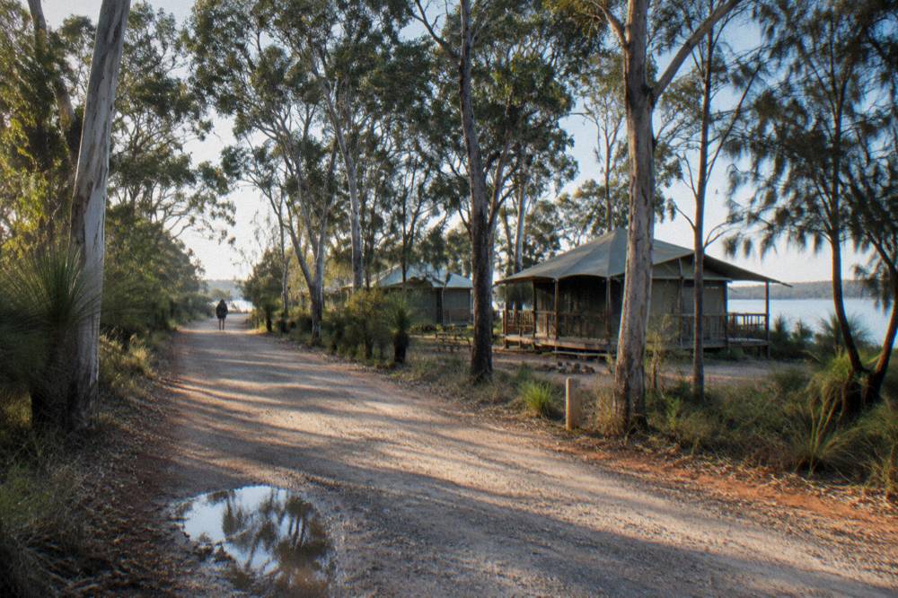
Public transport reaches Tewantin but not the water. TransLink routes 627 and 628 connect the Noosa area to Tewantin on regular daytime timetables, and from Tewantin the remaining 19 km to Boreen Point needs a taxi, a rideshare or an arranged transfer. This is why the pickup question in the launch table matters: a visitor without a car is choosing between the canoe barbecue day's arrangeable transfers, the private hinterland day's included pickup, or a short cruise with a taxi fare on each end. The full transport picture, including the airport and ferry angles, is in the getting to the Everglades from Noosa and Brisbane guide.
The official road distances come from the QPWS Upper Noosa River waterway page, which also carries the current park alerts in its footer, and the bridge and amenities notices come from Noosa Council's own project pages. Check a mapping service for live drive times from your accommodation; the figures here are the fixed distances, not the traffic-adjusted ones.
The Landmarks: Kinaba, Fig Tree Point And Harry's Hut
Kinaba Information Centre sits at the top of the lake crossing, 4.5 km by canoe from Elanda Point, with flush toilets, a lookout and stingrays often visible in the water around the building. Two km upstream is Fig Tree Point, then 5 km further the historic Harry's Hut, a timber-getter's hut from the mid-1900s, with the day-use area offering toilets, picnic tables and drinking water that should be treated before use.
These three landmarks structure every tour narrative, and each appears on the waterway at the distances in the route table. Kinaba, also called the Sir Thomas Hiley Information Centre, is where commercial boat tours drop in on their runs, and the 6.1 km one-way walk from the Elanda Point car park, about 2 hours, is the land-based alternative for visitors who want the boardwalk and lookout without a boat. The Kinaba detail, including the walk, is covered in the Kinaba Information Centre guide.
Fig Tree Point is the first campsite landmark and the busiest junction on the river, where the waterway widens and the campsites begin. It takes up to 3 groups of 8 people, 24 in total, with toilets, picnic tables, a jetty and a canoe landing, and it holds waterbirds, cormorants, wood ducks, egrets, spoonbills and darters, at their best in the early morning or late afternoon. Note the no-landing zone between Fig Tree Point and Harrys Hut, one of the few hard rules on the waterway that catches paddlers out; the banks between those two points are closed to landing, so lunch stops need planning around the named areas.
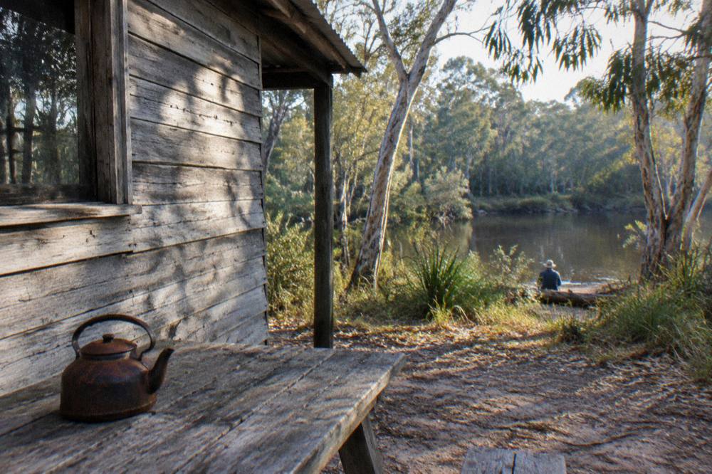
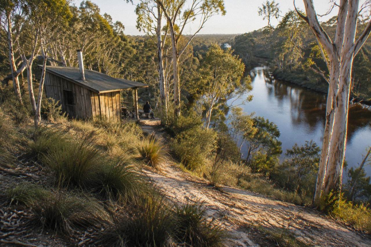
Harry's Hut is the mid-river anchor and the turnaround point for most day tours. The hut itself is a relic of the winch-and-crane operation that once transported logs across the Noosa River, and the surrounding camping and day-use area is the last place with road access from the north-west, by high-clearance 4WD on Harrys Hut Road. For water-based visitors it is simply the best picnic stop on the river, with non-flush toilets, picnic tables and a water supply that the park service advises treating before use. The history and the camping rules are in the Harrys Hut guide.
Beyond Harrys Hut the character changes again. The campsites run 1 to 15 up the narrowing river, the motorised traffic ends at campsite 3, and the paddlers' territory begins in earnest. Campsite 3 is currently under a partial jetty closure until 24 October 2026, with the southern day-use jetty flood-damaged and the northern camper's jetty open, a detail worth checking if your itinerary touches that site. The far campsites, the multi-day paddles and the permit rules that govern them all belong to the camping cluster of guides, starting with camping in the Noosa Everglades.
Planning Your Own Route: Distances, Campsites And Timing
A realistic self-planned day covers Elanda Point to Kinaba and back, or Elanda Point to Harry's Hut and back if you start early and paddle hard, while the full 27.7 km one-way journey to campsite 15 is a multi-day trip with a suggested five hours of paddling time each way and camping permits required at every site, at $7.75 per person per night or $31.00 per family per night from 1 July.
The permit figures come from the park booking service, and the family rate covers one or two adults plus children under 18, up to eight people, with under-fives free. Maximum stay is 7 nights at campsites 1 to 15 and 14 nights at Fig Tree Point and Harrys. Open fires are prohibited at all Upper Noosa River campsites; bring a gas or fuel appliance. Book through the official service at parks.qld.gov.au camping bookings, and check the Cooloola conditions report before you travel; the current version was updated 30 September 2026 and confirms all river campsites, Harrys Hut and Fig Tree Point are open.
Timing a day trip is mostly arithmetic on the leg table. Elanda Point to Fig Tree Point and back is about 4.5 km plus 2 km each way, roughly 4 hours of paddling before stops, which fits a 6-hour day with lunch. Pushing to Harry's Hut adds another 5 km each way and about 2 more hours of paddle time, which is why the guided days that reach it start at 8:30am. The self-guided 6-hour kayak option from the same launch, from $85.68 per person with a 4.8 rating from 133 reviews, is the natural fit for that arithmetic, and the trade-offs between guided and self-guided are laid out in the how to choose a Noosa Everglades tour guide.
Weather belongs in the plan too. The nearest Bureau of Meteorology station with long-term averages is Tewantin, on the Noosa River itself, and its table shows October averaging a 25.8 degree maximum and 112.1 mm of rain, with September the driest month at 57.8 mm and March the wettest at 236.4 mm. Those are 30-year averages, not forecasts, and the lake crossing cares about wind more than rain, but the seasonal shape is clear: spring is the comfortable paddling window, and the monthly detail is in the Noosa weather by month guide.
For visitors weighing the whole question of whether the drive and the paddle repay the effort, the honest answer is that the map does most of the persuading: a 27.7 km protected river with a 2.5 km mirror stretch, an hour and a half north of a major tourist town, is rare geography. The is the Noosa Everglades worth it piece takes that question on directly, and the best way to see the Noosa Everglades compares the formats against each other.
The launch-point arithmetic also explains why the longer kayak days exist at all. The 7.5-hour self-guided option from Adventure Tribe, from $80 per person with a 4.8 rating from a thin sample of 16 reviews, spreads the same Elanda Point corridor across a longer window, 6 hours of it on the water, and leaves the lunch question to the paddler. It suits the confident visitor who has done the leg table above and wants the flexibility to linger at Kinaba or push past the Fig Tree Point junction without a guide setting the pace.
Whichever slice of the 27.7 km you choose, the same three decisions recur: launch at Boreen Point for a cruise or Elanda Point for a paddle, cross the lake before the wind rises, and turn the leg table into an honest timetable rather than a hope. The listings below are the three formats that cover the most river for their price, from the full-day guided paddle to the short cruise and the cruise-plus-canoe hybrid.
Common Questions About The Noosa Everglades Route
How long is the Noosa Everglades route?
The official waterway is 27.7 km one way, from Elanda Point across Lake Cootharaba and up the river to campsite 15, with a suggested five hours of paddling time. Day tours cover a slice of it, usually between Kinaba and Harry's Hut.
How far is Boreen Point from Kinaba?
Seven km by boat across Lake Cootharaba, about 15 minutes for the cruise fleet under the lake's 40-knot limit. By canoe the equivalent crossing starts at Elanda Point instead, 4.5 km and about 1.5 hours to Kinaba.
Can you drive to Harry's Hut?
Yes, but only by high-clearance 4WD on Harrys Hut Road from the north-west, and no tour uses that approach. Most visitors reach Harrys by boat or canoe, 5 km upstream from Fig Tree Point.
Do you need a 4WD to reach the Noosa Everglades launch points?
No. The park service states both Boreen Point and Elanda Point launching areas are accessible by 2WD vehicles, via Tewantin, McKinnon Drive, Louis Bazzo Drive and Lake Flat Road. The 4WD country starts further north in the Cooloola Recreation Area.
Where does the Noosa Everglades route end?
At Upper Noosa River campsite 15, the furthest point upstream, 3 km past campsite 13. The park service states it is not possible to proceed beyond campsite 15, and motorised vessels are not permitted past campsite 3 in any case.
Which launch point should I use, Boreen Point or Elanda Point?
Use Boreen Point for the cruise tours, which depart from the boat ramp there. Use Elanda Point, 2 km further along Lake Flat Road, for kayak and canoe days, including every guided and self-guided kayak tour on this site.