Kinaba Information Centre: What To Expect On The Upper Noosa River
Kinaba sits where the tannin waters of the upper Noosa River meet the edge of Lake Cootharaba, a small QPWS building with flush toilets, a lookout and stingrays in the shallows. Here is what it offers, how to reach it, and what the river rules mean for your visit.
Short answer
Kinaba, also called the Sir Thomas Hiley Information Centre, is a Queensland Parks and Wildlife Service building on the upper Noosa River with flush toilets, a lookout and stingrays often seen in the water nearby. It sits 4.5 km by canoe from Elanda Point, about 1.5 hours paddling, and commercial boat tours drop in.
What Is The Kinaba Information Centre?
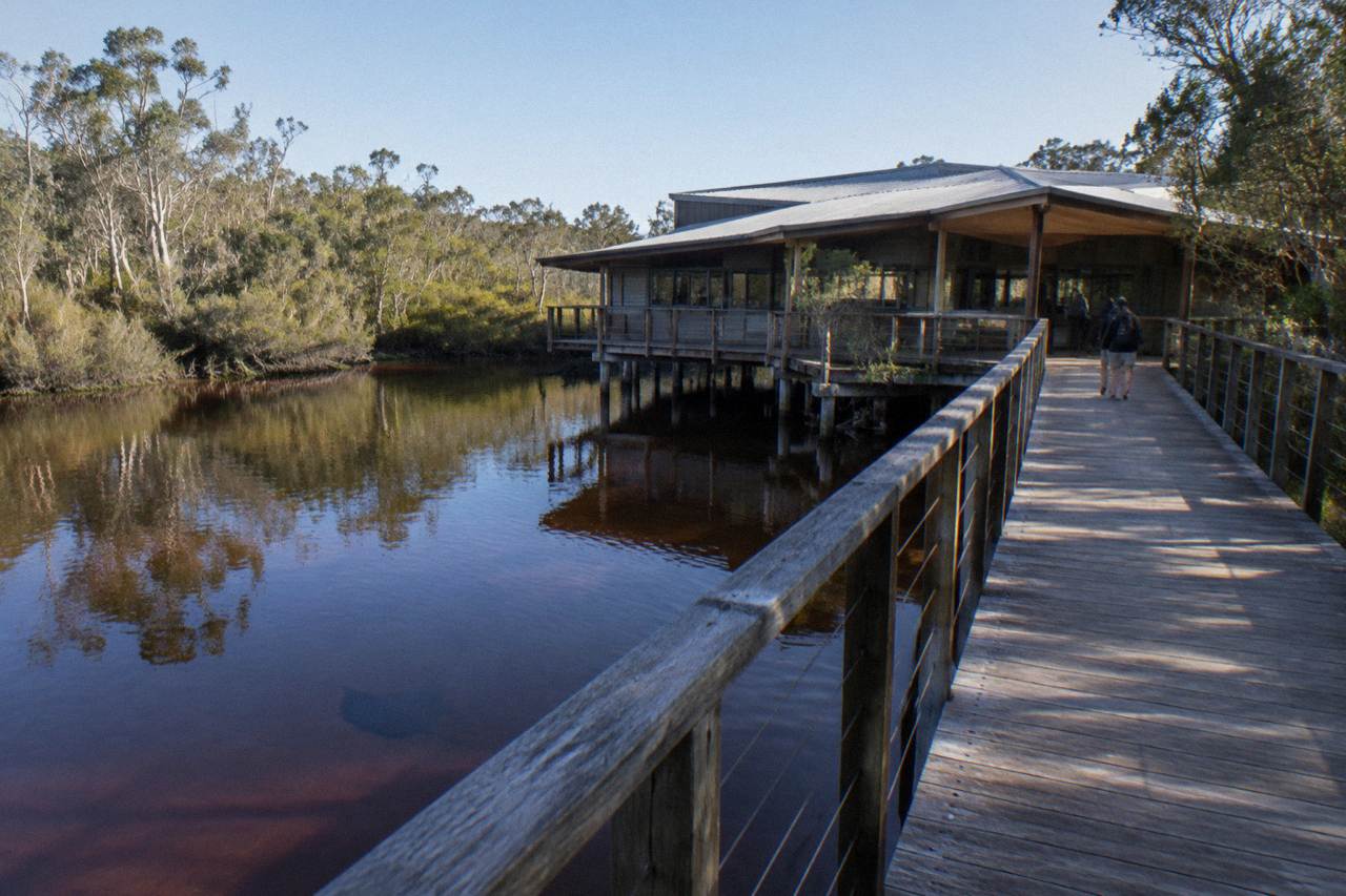
The Kinaba Information Centre is a small Queensland Parks and Wildlife Service building on the upper Noosa River, inside the Cooloola Recreation Area of Great Sandy National Park. It is also formally named the Sir Thomas Hiley Information Centre. The centre serves visitors exploring this part of the park, providing information about the area and its surrounds. It offers flush toilets, a lookout over the tannin-stained water, and a chance to spot stingrays in the shallows around the building. The QPWS waterway page records that commercial boat tours on the upper river drop in at Kinaba, so most visitors arrive by vessel rather than on foot. It is a stopping point on a 27.7 km one-way river journey, not a destination with a car park at the door.
The centre sits at a genuine transition point on the river. Below Kinaba, the water opens toward Lake Cootharaba and the boat traffic that comes up from Boreen Point. Above Kinaba, the character changes: a six-knot, no-wash speed limit applies from the centre upstream, protecting the paperbark and bloodwood banks from erosion, and the river narrows into the stretch operators call the River of Mirrors, which QPWS names The Narrows. That naming split matters. The "Everglades" language and the "one of only two everglades in the world" claim come from tour operators and their listings, not from the parks service. QPWS calls this waterway the Upper Noosa River in the Cooloola Recreation Area.
There is no entry fee and no booking needed to step inside. The building is modest, and visitors who arrive expecting a museum-style visitor centre with exhibits and staff should recalibrate: the value is the location, the facilities and the lookout, and the fact that nearly every boat trip up the river pauses here. If you are planning a wider trip around the region, the Noosa Everglades Tours homepage lays the cruises, kayak days and canoe options side by side, which is the fastest way to see where Kinaba fits in.
The building's second name is worth knowing when you are reading maps and signs. Older references and some official pages use Sir Thomas Hiley Information Centre, and the two names refer to exactly the same spot. Search for either and you will find the same boardwalk, the same lookout and the same stingrays.
Where Is Kinaba And How Do You Get There?
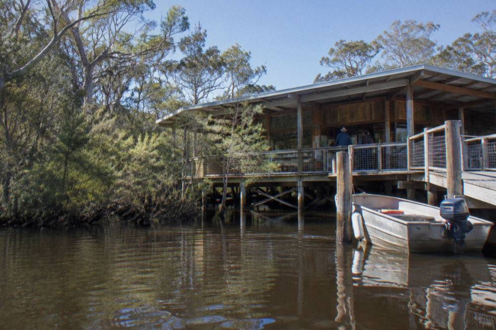
Kinaba sits on the upper Noosa River at the northern edge of Lake Cootharaba, reachable by canoe, kayak or boat, or on foot via a 6.1 km one-way walk (about 2 hours) from the Elanda Point car park. There is no road to the building itself. The QPWS access notes say to travel 1.4 km from Lake Flat Road to the Elanda Point car park, then take the walking track or launch a paddle craft from there. From Boreen Point, the trip is 7 km by boat, about 15 minutes at the permitted speed.
Both launch points are conventional-2WD accessible, which surprises visitors who assume a trip into a national park waterway needs a four-wheel drive. Boreen Point has a boat ramp suited to powered vessels, while Elanda Point is the canoe and kayak launch. Operators at both points hire paddle craft, and the QPWS waterway page states that tour boats operate daily from Noosa and Tewantin. Paddling from Elanda Point to Kinaba covers 4.5 km and takes about 1.5 hours at a steady canoe pace, which makes it one of the gentler half-day paddles in the region.
The foot track is the quiet option. Six kilometres each way through open woodland and heath is a genuine half-day commitment, and the same habitat is koala country: Noosa Council identifies land around Boreen Point and Lake Flat Road as koala habitat within wildlife corridors near the national park. Walkers should carry water, wear closed shoes and expect sections of soft sand. The reward is arriving at a river building most people only ever see from a boat deck.
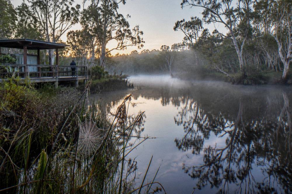
Timing matters more than most first-time visitors expect. QPWS advises planning to cross Lake Cootharaba early in the morning, when conditions are likely to be calm and travel is easiest. The lake is shallow and open, and an afternoon breeze can turn a 15-minute boat hop into a bumpy one. Early starts also put you at the stingray shallows before the day's traffic stirs the water up. If you are still deciding how a river day fits a wider stay, the Elanda Point guide covers the launch area, parking and the walk-in campground options in detail.
For anyone weighing a paddle against a boat, the practical difference is the lake crossing. Canoeists hug the shoreline and take the longer, sheltered line; powered boats go straight across. Both end up at the same boardwalk.
Which Tours Pass By Kinaba?
QPWS states plainly that commercial boat tours on the upper Noosa River drop into Kinaba, and the river's cruise listings all operate on the same waterway, but only a listing's own description confirms whether a specific stop is scheduled on any given departure. The parks service does not name individual operators on the waterway page, so treat any "we stop at Kinaba" promise as coming from the tour's own text, not from the park authority. What is certain is the geography: every cruise heading upstream toward The Narrows passes the centre, because the river narrows beyond it.
The cruise options on this site split into two practical shapes. The 2.5-Hour Afternoon Cruise departs Boreen Point, runs 2.5 hours, includes a glass of sparkling wine, beer or juice, and is priced from $69 per person, with a 4.5 rating from 1,093 reviews, the deepest review pool on the roster. Free cancellation applies up to 24 hours before. The Afternoon Tea Cruise, operated by Everglades Eco Safaris, is a similar shape at about 2 hours 30 minutes, from $70.10 per person, rated 4.5 from 472 reviews, with a 36-person vessel capacity; the operator asks 48 hours notice for cancellations. You can check availability on the afternoon cruise listing or Check availability for the operator's live dates.
Longer days reach further up the river. The 4.5-Hour Cruise, Lunch Extra listing runs 9am to 1.30pm from $117 per person, rated 4.6 from 279 reviews, with morning refreshments included and lunch to buy at the on-site bar and bistro. The 6-Hour Canoe Trip, BBQ Lunch Extra listing from the same operator family, lists about 6 hours at from $119.67 per person, rated 4.6 from 379 reviews, and combines the cruise with a canoe paddle; round-trip transfers from central Noosa can be arranged, confirmed at booking. Note the duration difference between the two Explorer listings: one states 4.5 hours, the other about 6, and each figure belongs to its own listing.
Paddle-first days pass Kinaba too. The full-day guided kayak tours from Kanu Kapers Australia meet at the Elanda Point Canoe Launch, start 8:30am, and run about 6 hours with lunch, fresh fruit, baked bread and drinks included, from $148 per person, rated 4.9 from 158 reviews, in groups up to 16. The self-guided version from the same operator is from $85.68 per person, rated 4.8 from 133 reviews, with no meal listed and groups up to 20. Neither listing includes pickup, so plan your own transport to the launch. For a fuller comparison of the cruise families, the Noosa Everglades cruise guide breaks down the afternoon, morning and canoe-combination options.
How Far Is Kinaba From Key Points On The River?
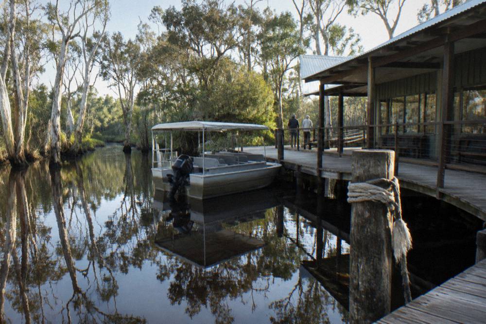
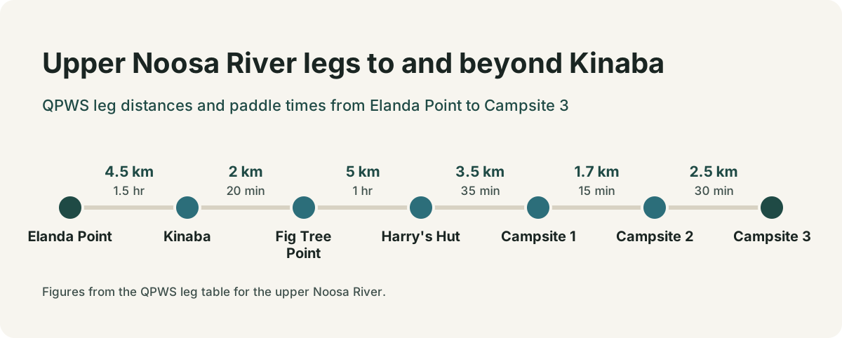
Kinaba is 4.5 km from Elanda Point by canoe (about 1.5 hours), 7 km from Boreen Point by boat (about 15 minutes), 2 km from Fig Tree Point (20 minutes paddling), and 5 km from Harry's Hut (about 1 hour by canoe). These are QPWS's own leg figures for the waterway, and they are the numbers to plan a day around, whether you are paddling, motoring or walking. The full journey the centre sits on is 27.7 km one way, with a suggested 5 hours of paddling time end to end.
The legs matter because the river above Kinaba changes the rules. A six-knot, no-wash speed limit applies upstream from the information centre, and QPWS warns that penalties apply for vessels that generate wash. Motorised vessels are permitted only as far as Campsite 3; beyond it, only electric motors and non-motorised craft may continue. There is also a no-landing zone between Fig Tree Point and Harry's Hut, which catches out paddlers who assume every bank is a lunch stop. The practical read: Kinaba is the last easy turnaround point for powered day trips and a natural rest stop for everyone else.
| Leg | Distance | By canoe | By boat |
|---|---|---|---|
| Elanda Point to Kinaba | 4.5 km | 1.5 hr | not applicable |
| Boreen Point to Kinaba | 7 km | not applicable | 15 min |
| Kinaba to Fig Tree Point | 2 km | 20 min | 15 min |
| Fig Tree Point to Harry's Hut | 5 km | 1 hr | 30 min |
| Harry's Hut to Campsite 1 | 3.5 km | 35 min | not stated |
| Campsite 1 to Campsite 2 | 1.7 km | 15 min | not stated |
| Campsite 2 to Campsite 3 | 2.5 km | 30 min | not stated |
Walkers get their own figure: the track from the Elanda Point car park to Kinaba is 6.1 km one way, about 2 hours each direction. That is a 12 km round trip on foot, which is a different proposition from a 9 km round paddle, and the two are often confused in planning threads. The walk and the paddle share the same start point and the same destination, but they suit different days, different fitness levels and different amounts of gear.
It is not possible to proceed upstream beyond Upper Noosa River campsite 15, so the river has a hard end even for the most determined paddlers. Most day visitors turn around at Harry's Hut or, on shorter days, at Fig Tree Point. If you want to map the whole route before committing, the map and route guide lays out the waterway, the campsites and the landmarks in order.
What Wildlife Will You See Around Kinaba?
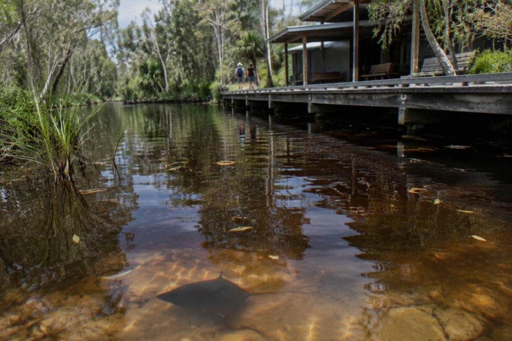
The signature sighting at Kinaba is stingrays: the QPWS page for the centre specifically tells visitors to look for stingrays in the waters around the building, and the still, tannin-dark shallows near the boardwalk are where they are most often spotted. Beyond that, the wider Cooloola Recreation Area records more than 350 bird species, 75 mammal species, 21 frog species and 80 reptile species, and the upper river and lake systems are noted for frog choruses. Those are whole-of-park figures, not a Kinaba-only count, so read them as what the region holds rather than a promise for one boardwalk.
The waterbirds are the reliable daily show. At Fig Tree Point, 2 km upstream, QPWS lists cormorants, wood ducks, egrets, spoonbills and darters as early-morning and late-afternoon sightings, and the same species work the Kinaba shallows. The tannin-stained water is the reason the reflections are so striking: the dark colour comes from the tea-coloured runoff of the paperbark and heath country, and it mirrors the twisted trees along the banks. Operators call the stretch the River of Mirrors; QPWS calls the 2.5 km section The Narrows. Both describe the same water.
On the mammal side, the land around the launch points is koala habitat. Noosa Council has identified remnant vegetation purchases on Lake Flat Road as koala habitat and wildlife corridor connecting toward the national park, and Noosa National Park to the south is confirmed koala country. Koalas are seen, not promised: they are cryptic, high in feed trees, and a sighting is luck plus patience. The park's rarer residents, the Cooloola acid frogs and the ground parrot, are heard far more often than seen, and the acid frogs in particular call from the wet heath and the river margins at night.
On the safety questions visitors always ask, the honest answer is about what is not stated. No official Queensland Government, QPWS or Noosa Council statement was found confirming crocodiles in the Noosa River, the upper river, Lake Cootharaba or the Cooloola Recreation Area, on the parks pages for Cooloola (visiting safely, FAQ, upper Noosa River waterway) or on Noosa Council's rivers and creeks pages. That is an absence of an official statement, not a guarantee, so do not read it as one. Noosa Council does monitor recreational water quality at Boreen Point and Elanda Point sites and advises avoiding swimming near drains, in discoloured or murky water, or shortly after heavy rain. For the full picture, the are there crocs in the Everglades article walks through exactly what was and was not found on the official pages.
What Facilities Does Kinaba Offer?
Kinaba offers flush toilets, a lookout over the river, and a boardwalk building you can step inside, which is a step up from every facility further upstream: Harry's day-use area has non-flush toilets, and the numbered river campsites mostly have composting or no toilets at all. Drinking water is provided at Harry's day-use area with a treat-before-use warning, but no water supply is guaranteed, so carry your own. Kinaba is the last flush toilet on the waterway, a fact that matters more on a six-hour day than most planning lists admit.
There is no shop, no cafe and no staffed desk at the centre. Lunch on the longer tours is either included in the listing or bought at the on-site bar and bistro at the departure base, not at Kinaba itself. The 4.5-hour cruise listing includes morning refreshments with lunch to buy on site; the guided kayak days include lunch, fresh fruit, baked bread and drinks; the afternoon cruises include one drink (sparkling wine, beer or juice) and nothing more. Plan food around the tour, not around the centre.
| Facility | Kinaba | Fig Tree Point | Harry's day-use area |
|---|---|---|---|
| Toilets | Flush | Toilets, picnic tables | Non-flush toilets, picnic tables |
| Lookout | Yes | No lookout listed | No lookout listed |
| Jetty or landing | Boardwalk access | Jetty and canoe landing | Day-use area access |
| Drinking water | Not stated | Untreated water | Provided, treat before use |
| Group limit | Not applicable | Up to 24 people total | Not stated |
Rubbish is a carry-out affair across the whole upper river. QPWS asks that all rubbish be taken out, and portable toilets are recommended for camping away from facilities at campsites 4 to 15. The ethic on this waterway is simple: everything that comes up the river goes back down it. Feeding wildlife is prohibited, and the birds around the jetties will test that rule by looking hungry.
The building itself is worth a slow lap. The lookout gives a framed view down the lake channel and up the river, and on a still morning the water around the boardwalk poles is where the stingrays work the shallows. Give it twenty minutes rather than five and you will see why the tours pause here.
When Is The Best Time To Visit Kinaba?
The best time to reach Kinaba is early morning, when Lake Cootharaba is calm, wildlife is active, and the QPWS advice to cross the lake early holds; on climate averages, September is the driest month (57.8 mm) and March the wettest (236.4 mm) at the nearest Bureau of Meteorology station, Tewantin. October averages 25.8 degrees maximum and 112.1 mm of rain over about 8 rain days, which is a comfortable but not dry window for a river day.
The climate record comes from the Tewantin station, number 040908, with 30 years of data, the nearest long-record station on the Noosa River. One nuance in that table is worth knowing: the median rainfall is lower than the mean in every month, because a few very wet years pull the average up. So the averages are a planning guide, not a forecast; treat any single month as capable of being drier than the number suggests. Summer brings the warmth and the frog choruses; spring brings the lower rainfall figures and the wildflower season in the heath; winter brings the coolest paddling temperatures, with July averaging 21.4 degrees maximum and just 71.7 mm of rain.
| Month | Mean max | Mean min | Mean rain | Rain days |
|---|---|---|---|---|
| January | 28.7 C | 22.0 C | 149.8 mm | 10.7 |
| April | 26.0 C | 18.2 C | 151.6 mm | 11.7 |
| July | 21.4 C | 11.3 C | 71.7 mm | 7.1 |
| September | 24.4 C | 14.6 C | 57.8 mm | 5.8 |
| October | 25.8 C | 17.1 C | 112.1 mm | 8.0 |
Day shape matters as much as month. Cruises depart on fixed schedules: the afternoon cruise runs 2.5 hours from Boreen Point, the 4.5-hour cruise runs 9am to 1.30pm, and the kayak days start 8:30am and run about 6 to 7.5 hours depending on the listing. The 8:30am starts exist precisely because the lake is calmest early, which is also when the stingray shallows at Kinaba are at their clearest. An afternoon departure trades calm water for a later start and the golden-hour light on the paperbarks, a fair swap for photographers.
Crowd pressure in the area follows the calendar more than the weather. The Queensland spring school holidays ran 19 September to 5 October 2026, and the Noosa Triathlon on Sunday 1 November 2026 brings road closures and accommodation pressure around Noosa Main Beach. Neither touches the river directly, but both shape how early you need to book a cruise seat and where you will find a bed. For the month-by-month detail, the best time to visit guide works through the seasons, and the which month is best article answers the same question for readers deciding between spring and summer.
Can You Camp Near Kinaba?
You cannot camp at Kinaba itself, but the river campsites begin a short paddle upstream: Fig Tree Point, 2 km away, takes up to 3 groups of 8 people to a maximum of 24 in total, and the numbered Upper Noosa River campsites 1 to 15 run on from there, all requiring permits booked in advance. Camping fees are $7.75 per person per night or $31.00 per family per night, with children under five free. The maximum stay is 7 nights at campsites 1 to 15 and 14 nights at Fig Tree Point and Harrys.
Access shapes which site suits you. Fig Tree Point is river access only, by canoe, kayak or boat; there is no vehicle access, and no vehicle access permit is needed for Harrys Hut Road or Cooloola Way when launching from that side. The numbered campsites are paddle-in or boat-in, with motorised vessels permitted only as far as Campsite 3. Campsite 3 has a composting hybrid toilet, platform tables and jetties, though its southern day-use jetty is closed until 24 October 2026. Portable toilets are recommended for campsites 4 to 15, where facilities thin out.
The camping day and the Kinaba day combine naturally. Paddle or cruise up to the centre on day one, push on to Fig Tree Point or Harrys Hut to camp, and drift back down the next morning. Multi-day self-guided kayak options from Kanu Kapers include camping equipment and depart from the Elanda Point launch area, which is the same car park the Kinaba walking track starts from. For the site-by-site detail, the upper river campsites guide covers all fifteen numbered sites, and the Fig Tree Point guide covers the group campsite closest to Kinaba.
Planning Your Visit: Alerts, Access And The Details That Change
Before any Kinaba trip, check the Cooloola conditions report, which was updated 30 September 2026, because the current alerts touch this waterway directly: the Campsite 3 jetty closure runs to 24 October 2026, and a pest control program runs 31 October to 28 November 2026 across the recreation area. Neither closes Kinaba or the river itself, but both shape where you can land, moor and camp, and the conditions report is the park authority's own word on track and water status.
Getting to the launch points has its own moving parts. Doonella Bridge in Tewantin runs one-way eastbound only, from Tewantin toward Noosaville, from 6 July 2026 into early December 2026, with westbound traffic detoured via Eumundi-Noosa Road and Beckmans Road; drivers routing north from Noosaville toward Lake Flat Road should expect the detour to add time. At Boreen Point itself, the N4 amenities block on Boreen Parade is closed for roof replacement from 19 to 24 October 2026, with alternatives about 500 m away at the N3 block at the Urangan Parade boat ramp and the N5 picnic area at the caravan park. The Elanda Point and Lake Flat Road access has no reported works.
Public transport gets you to Tewantin, not to the river. TransLink routes 627 and 628 run from the Noosa area to Tewantin, with route 628 showing roughly hourly daytime departures from Noosa Junction; a single 2:52pm route 627 service to Tewantin was cancelled on 1 October 2026 due to bus availability, a reminder that same-day bus connections on this corridor can wobble. From Tewantin to Boreen Point or Elanda Point you need a car, a taxi, an arranged transfer or a tour that includes one. Pickup terms differ by listing: the private hinterland day includes hotel pickup and drop-off across the Sunshine Coast, Noosa and Hinterland; the canoe BBQ day can arrange round-trip transfers from central Noosa, confirmed at booking; the afternoon cruise and the Explorer cruise both include a courtesy shuttle from selected Noosa stops, with pickup times confirmed after booking; the kayak days have no pickup; for the afternoon tea cruise, check the live booking page.
On the water, the rules are enforced and specific. Six knots and no wash upstream from Kinaba. Motorised vessels only to Campsite 3. No landing between Fig Tree Point and Harry's Hut. All Maritime Safety Queensland regulations apply, and across the whole Noosa River system a 28-day anchoring limit per financial year applies to vessels over 5 m. The full rule set lives on the QPWS Cooloola things to do page, and the leg distances and journey details are on the upper Noosa River waterway page.
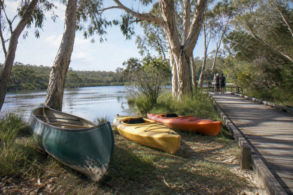
For readers deciding between the boat and the paddle, the honest summary is this. A cruise gets you to Kinaba and up into The Narrows with no fitness requirement, a drink in hand and a skipper who knows the channel; a kayak day gets you the silence between the boat runs, the stingray shallows to yourself and a lunch stop the tours cannot always wait for. The two best-reviewed listings on the waterway reflect that split: the afternoon cruise holds 4.5 from 1,093 reviews, and the full-day guided kayak holds 4.9 from 158 reviews. The how to choose a tour guide walks the whole decision, budget first.
Common Questions About The Kinaba Information Centre
How long is the walk to the Kinaba Information Centre?
The walking track from the Elanda Point car park to Kinaba is 6.1 km one way, about 2 hours each direction, so a round trip is roughly 12 km and 4 hours of walking. Carry water and start early.
Can you drive to the Kinaba Information Centre?
No. There is no road to Kinaba. You reach it by canoe, kayak or boat from Elanda Point or Boreen Point, both of which are accessible by 2WD, or on foot via the 6.1 km track from the Elanda Point car park.
Are there toilets at Kinaba?
Yes. Kinaba has flush toilets, which makes it the most developed facility on the upper river. Harry's day-use area has non-flush toilets, and the numbered campsites have composting toilets or none at all.
Do tour boats stop at Kinaba?
QPWS states that commercial boat tours on the upper Noosa River drop into Kinaba, and every cruise heading upstream passes it. Whether a specific tour schedules a stop is stated on that tour's own listing, so check the listing description before booking if a Kinaba stop matters to you.
Can you see stingrays at Kinaba?
Yes, stingrays are regularly seen in the waters around the building, and the QPWS page for the centre says to look for them. Early morning, when the lake crossing is calm, offers the clearest water for spotting them.
Why is it also called the Sir Thomas Hiley Information Centre?
Sir Thomas Hiley Information Centre is the same building under its formal name. The two names refer to the same spot on the upper Noosa River, and maps or signs using either name mean the same boardwalk, lookout and toilets.